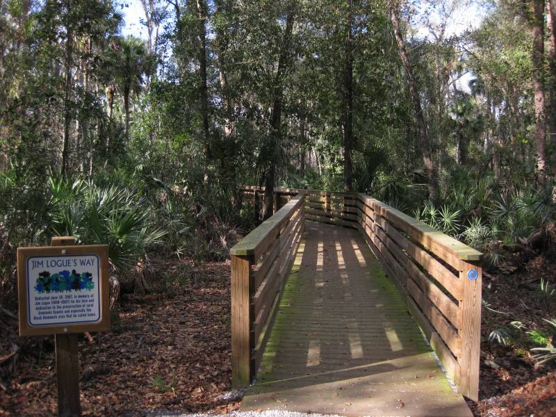
Black Hammock Wilderness Area
Black Hammock Wilderness Area is a 700-acre wooded tract in east Seminole County, Florida, near Geneva. Mixed hardwood swamps, sand pine scrub, and pine flatwoods sit close together here, so a short walk can move you through several habitats in one morning. Barred owls, bobcats, eastern hognose snakes, and white-tailed deer show up most often for visitors who pause on the long boardwalks and keep voices low.


Directions
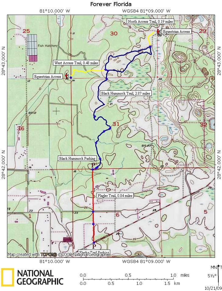
From exit 223 on I-95 near Mims, go west toward Geneva on State Road 46 for about 16.3 miles. Turn left on State Road 426 and head toward Oviedo. After about 5 miles, turn right on Van Arsdale Street, left on Florida Avenue, right on Stone Street, then right again on Howard Avenue. Trailhead parking is on the left near the end of the road.
Hiking
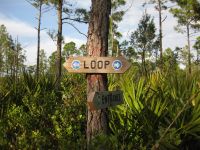
A 2.9-mile foot trail samples a good cross-section of the Black Hammock Wilderness Area. The main parking area is at the end of Howard Avenue, and other footpaths connect if you want a longer loop through scrub edges and swamp lines. Expect two long boardwalks, large magnolias, and a few chainsaw carvings that regulars use as informal landmarks along the route.


Trail Tips
Boardwalks here stay slippery after rain, and afternoon storms roll in fast on summer days. Start early, carry extra water, and plan a turnaround time if thunderheads build to the east. Cooler months bring drier air and easier pacing for photography, but mosquitoes and biting flies still appear when the wind goes calm.
This tract sits in a wet part of the Geneva-Oviedo countryside, so treat every dark pool and ditch as possible alligator habitat. Stay on marked footpaths, give snakes a wide berth, and pack out all trash. Seminole County sometimes posts short closures for storm damage, bridge repair, or prescribed fire near the trail system, so read the kiosk sheet and confirm details on the Greenways page linked below before a long drive.
Tree canopy can weaken phone data. Save the topo map from this page to your device or print a paper copy before you leave home. If you use optional side paths, keep the printed map folded in a zip bag so it survives sweat and humidity.
Maps
GPS Data
Local Weather

Trail Reports
- No trail reports have been posted here lately. If you notice a major change on the ground, consider sharing details with local land managers through the Seminole County contact on the link list.
Links
Content last reviewed April 2026. Original page updates dated back to 21-Oct-2009.